| | --- |
| | license: apache-2.0 |
| | --- |
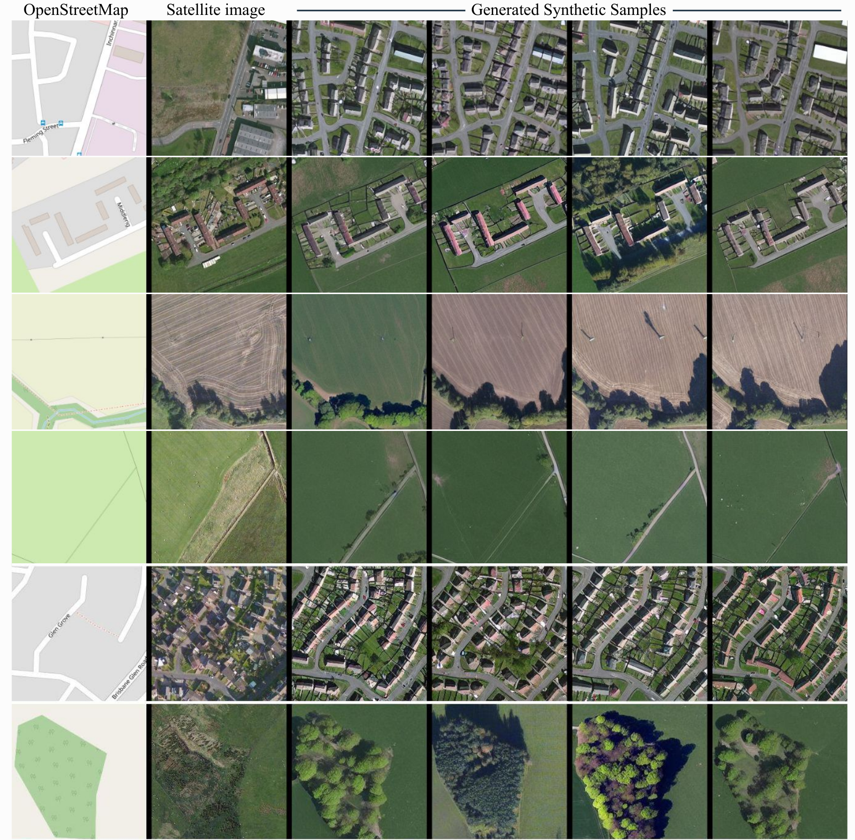
| | # Model description |
| |
|
| | ControlNet model conditioned on OpenStreetMaps (OSM) to generate the corresponding satellite images. |
| |
|
| | Trained on the region of the Central Belt. |
| |
|
| | ## Dataset used for training |
| | The dataset used for the training procedure is the |
| | [WorldImagery Clarity dataset](https://www.arcgis.com/home/item.html?id=ab399b847323487dba26809bf11ea91a). |
| |
|
| | The code for the dataset construction can be accessed in https://github.com/miquel-espinosa/map-sat. |
| |
|
| |  |
